Showing posts with label Derbyshire Walks. Show all posts

Monday, 31 January 2011

Repton, Derbyshire

Tuesday 4 January 2011
It snowed again this morning and so we had a lazy morning before deciding to go out for a walk. We drove to Repton and parked near the centre and then walked through the village. Repton turned out to be a lovely place; the ancient capitol of Mercia and home of Repton public school, whose lovely buildings were scattered around the village. We headed off along the edge of the school playing field and then up onto Parsons Hills.
We had lovely views across the Trent and although the path was narrow and on a slope, it was frozen so was not as slippery as it could have been.


We crossed some fields towards Newton Solney, again, luckily the field was frozen as the cows had churned it up quite a bit. Having arrived in Newton Solney we walked through the village and then onto a footpath heading back through the fields back towards Repton. We had been finding caches along the way and having found the last of a series we had to do some complicated maths to find the bonus cache. We had not really left early enough and so by the time we were searching for the bonus it was dark. We could not find it so decided to return to the car and come back tomorrow for the bonus. When we got to the car we spotted a mistake in our sums and realised the cache was only 100m away so headed back with torches to get the last cache. It had been a lovely walk in an area we had not visited before.

Thursday, 21 October 2010

Brailsford, Derbyshire

Sunday, October 17, 2010
Another beautiful day, although frosty when we got up. We thought we couldn't waste it and so rather tan sitting and getting stiff after yesterdays walk we set out for another walk – but a bit shorter this time.
We drove to Brailsford in Derbyshire and parked near Hazlehurst. There were several large dogs caged in the house opposite where we parked the car and so as we were getting ready and putting our boots on we had to put up with barking dogs disturbing the peace.
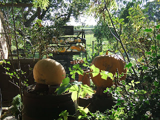
We headed down towards Kings Grove where we stopped to find a cache and then walked across the fields towards Commonside. We had to walk down a narrow lane and passed a small Market garden shop which had a lovely display of Autumn vegetables.


Then back up the field at Commonside but as the path was not marked we were at the wrong place to exit onto the A52. After a short diversion we found the way out and after a short walk down the main road and through a short bit of woodland we headed towards Brailsford Green. We left the footpath by going through a primary school playground and then headed across fields to a lane. We again had problems finding the footpath but got there in the end. More unmarked footpaths followed but we managed to stay on route and later passed through a field where sheep dog trials were being carried out.
We exited on a lane and again couldn't find the footpath but I finally noticed the footpath sign, covered by ivy on a post next to a tied up gate.
We went through the gate and struggled through a field of sugar beet, eventually reaching the other side of the field and our way onto the road where the car was parked. We had done a mere 8.75 km today but despite the difficulty finding footpaths was a pleasant walk.

Tuesday, 7 September 2010

PirateMania 4th September

Our first weekend at home for a while so we decided to go for a decent walk.
We headed to Ashbourne and to the UKGeocachers shop located in a caravan park, where we bought a few items and they kindly allowed us to leave the car in the shop car-park while we went for our walk. We had some problem finding the beginning of the walk as the footpath was not marked correctly on the map, but eventually we found our way out of the caravan park and across the field to a bridge. This walk had been set up during a Geocaching camping event, Piratemania, in the summer and so contained lots of geocaches.
We found the first one under a bridge and then followed the Bonnie Prince Charlie walk and the Centenary way towards Osmaston. One cache was found in a military type air-raid shelter, the woods that we walked in seemed to have several of these war-time buildings.

When we got to Osmaston we walked across the cricket field and continued along the footpath which passed though a field of 8ft tall maize. As we crossed into the next field I realised that it was full of young bullocks. As always happens they decided we were fun and decided to surround us, luckily the stile was close and I managed to hop over before we were cut off.


We passed through a short stretch of woodland and out onto the road before heading into another field. The cows in this field were happy to ignore us and then as we passed beside Osmaston lake a very large herd of cows decided to follow a couple going in the opposite direction to us. We waited by the side of the path as they all passed us by and then we walked on and through a natural wetland that had been provided with walkways to rise us above the boggy areas nd out to the road.
Shirley was a pretty village with several thatched cottages. The track through Shirley park led down to a water mill, and we realised that we had walked in this area some years ago, but from the opposite direction. (See April 4th 2007). Just past the mill we realised we had a cache to find. It was obviously hidden at a large tree but there was a family playing near it. We waited until they moved off and then went to find the cache, we realised that the cache was not hidden in a hole in the tree but was actually up in the branches. John nobly decided to climb up and found the cache after a short search – I don't think he had climbed a tree for donkeys years.


This was a figure of eight walk and so we passed back through Osmaston and then headed off through fields and woodland back towards Ashbourne and the end of the walk. We had walked 15.5 km and found 28 caches which I think was a record for us.

Thursday, 25 March 2010

Belper Hills Walk

Sunday 21st March
We have done some walks recently but most have been short geocaching walks. This walk was a bit longer.
The day started badly as I discovered I had lost an earring. It was one of the nice diamond studs John bought me for Christmas a few years ago. We had a good hunt round but no luck.
The weather was going to be good so we decided to do the Belper Hills walk. This was a series of caches set up for the event we attended last week. We decided not to follow all the cachers last week but to come back and enjoy the walk on our own.
We arrived and parked at about 11.30 am and set off on the walk. Wes tarted off by walking out of Belper and past the church to find a cache hidden in an Alley. We were off to a bad start as we didn’t find this one. The next cache was attached to an information board about a philanthropist who provided a lot of facilities for Belper. We then headed out of the town, past the very impressive weir and along a path beside the river Derwent. We headed up the lane and as there were several people about we decided to sit by a small waterfall and have a cup of coffee whilst they passed. We then headed up the hill, finding a cache and then through a farmyard. As we approached the next cache we saw someone lurking – it turned out to be another cacher mJamezz, so we had a chat and hunted unsuccessfully for the cache. We walked on and up the hill towards the next cache, chatting away. After finding the cache MJamezz left us as he was out for a run; we continued at our more sedate pace. We walked along the Midshires way with very good views across the hills and over Belper. We found the next cache and then as we approached the next one we spotted MJamezz again – he was having trouble finding the cache so we all hunted together again. John clambered up a tree and the cache was soon found. MJamezz ran off again and we walked down the cobbley path a bit more slowly. Surprisingly we met up again at the bottom of the hill where I found the next cache then as we walked down the road, MJamezz came running back towards us as he had left his map back at one of our previous caches. He caught up with us one last time before heading off at a run. We crossed the road and headed up the track towards Farnah Green. We continued along the hills and emerged on a road where we spotted a pub - The Bluebell, so had a break for a pint and a bag of crisps. We then set off for the last stage of the walk. After finding a few more caches we found ourselves surprisingly close to Belper. We walked along the river and crossed back towards the town. We had walked 12.4 km and found 18 caches along the route. We had been lucky enough to have had a lovely warm day with no wind.

Thursday, 18 March 2010

Markeaton Park to Kedleston


Saturday 20th February
Having had lots of short caching walks recently I decided we needed a proper walk so programmed a decent walk into the GPS –along with some caches of course. We drove to Markeaton park near Derby and after having trouble finding the parking area we finally found it and paid for 4hours +. We left the park, walked up the road and then headed off on a footpath leading to Markeaton Stones – I thought there might be something interesting there, but I think it was just the name of the farm as we didn't see anything. At the top of the lane we stopped to do a cache which was inside a tree and involved standing on a stump and leaning in, I was not tall enough so John had to retrieve the cache. Unfortunately, as he put it back he slipped and the cache fell down a hole into the depths of the trunk – oops, we will have to apologise to the cache owner.
We walked on and diverted off the path to find two more caches. After finding the first we started walking down the path only to have a big dog start barking at us. We stopped and wondered how friendly he was and as he did not come out of the farm drive we continued down the lane. Him, and his slightly smaller friend barked but did not come out as we walked past. We walked down a very muddy fields, found the cache and then had to walk back up the lane. The dogs had gone inside by this time so were no problem.
We followed a very muddy path past the boundary of Kedleston hall and out on to road. We could just about see the hall from where we stopped to have a cup of coffee. We walked up the road a little bit and then down the side of a garden centre. The footpath is missing from our new map but our old map still shows the path, we spent about half an hour hunting for a small cache which we were assured was still near the hedge but we didn’t find it but we did see lots of snowdrops in the area. We followed the footpath across fields and over some of the most dangerous stiles we’ve come across to the A52. We crossed the road and followed a path
through fields which were badly signposted and eventually found our way to the edge of a recently ploughed field.
We stood and watched a heron on a fencepost for a while, until I looked through the binoculars and realized it was plastic and then John walked across the field (so that he could map the footpath correctly) and I walked round the edge as it is such hard work walking across ploughed fields. We eventually emerged at Langley Common and went in to the Bluebell pub. We were too late for lunch but settled for a drink, sit down and a bag of crisps. However, someone else came in looking for a bowl of chips, so they agreed to put the friers back on and we had a lovely bowl of freshly cooked chips.
We left the pub and continued along the road and off onto a footpath at Radbourne Common. It was very slippy and muddy but we eventually got to a bridge where we were supposed to look for a cache but found it out on display and soaking wet. As we knew the cache owner had just broken his hip we did our best to dry the cache and put it back where it should have been hidden. We then struggled over some more stiles to the road.
After a stretch on the road we got to another footpath which went past a farm. Two large Alsatians were very vocal as we went past but luckily they were behind a fence.
We emerged at Mackworth and struggled to find the footpath that we needed to divert off to find a cache. We walked along the street searching; I turned round and could see the finger post hidden in the hedge beside someone’s garden. We went along the path, found the cache and then walked back to the road and off towards the pretty church. We found a cache near the church and then set off on the last stretch of the walk. A last cache was found just before we got back to Markeaton park having walked 18 km and found 7 caches. We had seen lots of snowdrops, robins, bluetits and a plastic heron

Sunday, 7 February 2010

Belper, Derbyshire


Saturday 30th January
It was a nice day so we decided on a Peak district walk. We drove to Belper and parked in the market place. It was lovely and warm as we left the car so we wondered if we needed coats, but took them just in case. We walked up the Butts and then onto a rough lane leading out of Belper. We stopped to find a cache in a field containing a nice horse called Partridge (or that’s what it said on his stable, any way). He munched on his hay whilst we hunted. We then continued up the hill and found another cache. It was the first of a series where we had to collect the numbers from the cache to find a final cache at the end of the walk. We got to the end of the lane, crossed the road and walked onto a track that went past a reservoir and then past a farm, across a field and through farm stables. There were several horses in the field but they ignored us. We ended up in the corner of a field where we had a cup of coffee and then went for a short diversion along a footpath that was along a disused railway and under a tunnel under the A38. It was an interesting path, the sleepers and tracks were still in place. John will map it on OSM when we get home. We walked back onto our route and followed the path through a lovely bit of woodland and over a stream. We emerged into Holbrook. There was a nice pub here – the Dead Poets which served very good beer but no food. We had a bag of crisps and ate our sandwiches in an alcove near a roaring fire. It was very cosy and we had to drag ourselves away to carry on with our walk. We walked along the road and then joined a farm track that led back towards Belper. It was bitterly cold now but we found a few more caches and completed the sums needed to get the co-ordinates for the final cache. Unfortunately my PDA decided it was too cold so stopped working and we were unable to get the co-ordinates to put in the GPS. We will have to come back to find that cache another time. We had found 12 geocaches and walked 10 km.

Saturday, 23 January 2010

Egglington, Derbyshire


Monday January 18th
As it was still dry we decided to go for another walk before the snow comes back in. We drove to Eggington (Derbyshire) and parked. We walked out of Eggington finding a few caches as we went, and then walked along the busy road, beside Eggington common. Everywhere was very wet and flooded. We walked along the Etwall road and then took the footpath that followed a lane past a farm. We were heading towards a cache called Shall we play a Game, which had been quite a fiendish puzzle. John had solved the tricky bit this time. We crossed a field with a stream running though it, although it was difficult to see where the stream really was as it had escaped it’s banks a bit and then we crossed a bridge and found the cache – being surprised to find we were only the second people to find it. We continued across the field and emerged onto the new Sustrans cycle path. We diverted along the path to look for a cache –we were unsuccessful this time, and decided not to continue along the path as it was so smelly – there is a nearby composting unit which may have been creating the pong, or it might just have been farming smells. We walked past Derby airfield and were treated to a light plane coming into land and then taking off just before it set down. We decided someone was having a flying lesson.
We had a bit of a problem finding the next footpath but eventually found the path and headed off across more very muddy fields before arriving back in Eggington. We walked through the village and visited the church, which has a working gaslamp outside. The church was locked but we did get to look around Wilfs retreat, a peaceful area which had been created from the BBC Breathing spaces scheme. We followed the road from the church towards the A38 but took a footpath just before we reached it. We had a bit of a problem deciding where the path went, but eventually found a stile which led into a field of sheep with new-born lambs. I bet they were pleased they hadn’t arrived last week. We had more trouble with the footpaths – they don’t mark them well around here, but eventually found one which led through the garden of a rather posh house. John decided the footpaths needed mapping correctly so we took a further lap round following all the paths. The paths were either not marked or had stiles which were very high and with no cross pieces. Not easy for people with short legs! They are obviously trying to dissuade walkers but John will now have all the footpaths on Open Street Maps. We had walked 9.3km.

Monday, 18 January 2010


Sunday January 17th
It was dry and all the snow had gone so after ages without a walk we had the opportunity to stretch our legs. We drove to Etwall, Derbyshire and parked near the church. We started off by getting lost, we followed a path which led through school grounds. We didn't think it was right but it was leading where we wanted to go and there were other people walking there. We got onto what appeared to be a path but we soon realised it was a path running above the path we wanted, and there was a fence separating us. We followed along the ridge and eventually found a way to get down onto the cycle path. We followed the lane and emerged into a different part of Etwall and then headed along a footpath across a very wet field leading to the busy A516. We took our lives in our hands as we crossed the road and headed into a field full of sheep. We were amused by the sheep as they all lined up to cross over a bridge, stand at the top to admire the view and then walk down again. We found a cache and then left the field and climbed up onto the disused railway. We diverted a little from the track to find some caches – one of which was hidden in the pocket of a scarecrows dungarees! We returned to follow the disused railway for a few miles, finding several caches as we went. There were several stretches of the path which were still very icy and slippery. The railway path eventually finished at Mickleover, where we walked around the roundabout and then followed very muddy fields to Burnaston. We eventually left the fields, with heavy boots clumped with mud, and walked along the lane back to Etwall. We had walked 12.7 km and found 14 caches.

Monday, 9 November 2009

Calke Walk Caches, Derbyshire


Friday 6th November
As rain was forecast this afternoon we left home early to do a caching walk at Ticknall. We parked behind the village hall in Ticknall and walked towards Calke Abbey, before we got to the drive we turned left and walked towards the new plantation and headed towards Vees wood. We had a diversion to find the first cache and then followed the path through the new woods. It was quite muddy and we were surprised to see deer slots in the mud. We walked through a lovely mature wood, named Robin wood, which was lovely as we could kick through all the fallen leaves. The path left the wood and we continued walking along the outside of the wood, until we emerged onto the track running towards the Melbourne to Ticknall road. We started to walk down the road but then found that there was a gap in the hedge which meant we could walk in the new plantation. We followed this for a while and then found that the path came to an abrupt end at a ditch. We had to clamber back onto the road and then re-enter the plantation a few yards further down (via the gate this time). This woodland is known as Poppy wood and after finding a cache and then been growled at by a dog - the owners just smiled sweetly, I had to return to the cache as I had left my walking pole there. We found a bench and sat and had a biscuit and then walked through the wood. There were lots of information boards telling us what had been planted in each section and how the woodland would be managed. We left the wood and walked down the bridleway leading to St Brides - a close of posh houses, and then found the footpath to the other Melbourne road. We walked down Robinsons Hill and took the footpath which led to Staunton Harold reservoir. We used the facilities and found a cache - which we were surprised to find we were the first to find. We then headed across the fields with good views of the reservoir. We crossed into the Calke estate and walked along the limeyards arriving back in Ticknall. We had walked 11 km. found 7 caches and got home just before the rain started.

Sunday, 15 March 2009

A short walk along the canal

Thursday 12th March 2009
We had planned to do a section of the Ivanhoe way today but as John had chopped down a lot of the hedge yesterday we decided we had better shred it so that it could go into the green bins for tomorrows collection. By the time this was done it was a bit late for doing a long walk.
Instead we drove across Swarkestone bridge and parked by the canal. we normally turn left along the canal when walking here but today we turned right and followed along the Trent and Mersey canal towards Weston on Trent.
It was a quiet afternoon and there were only a few cyclists about but we had a nice stroll watching the ducks, swans and barges.
We walked as far as Shenton lock finding two geocaches on the way and then turned back and headed towards Swarkestone lock.
By the time we got back we found we had walked 10 km, not much short of the walk that we had originally planned.

Sunday, 19 October 2008

Linton, Derbyshire, From Beer to Eternity cache walk

Thursday 16th October 2008
We drove to Linton, just inside Derbyshire to do a walk and hunt for a series of geocaches based on Breweries. We parked near Bee Hive fishing lakes and set off for our walk. The first cache was found as we reached the first stile for our walk. We climbed the stile into a field which had only just been planted with rape plants. The footpath had not been reinstated but there was the beginning of a trail of footprints so we followed that across several fields to the edge of a patch of woodland. The stile here was in a dangerous condition and collapsed as we tried to climb over. Luckily there was a very stiff and heavy gate next to it so we were able to continue. We walked beside some farm buildings with lots of large containers outside. We saw that each one had a run attached and contained a young calf. We continued walking through several new areas of National Forest. Top wood and Potters wood were quite advanced, with the trees being about 10 years old. We sat for a while beside a trig point on the top of the hill where we had a snack and then diverted off from the walk to find a cache. The diversion was very wet and the fields were squelchy but we found the cache and retraced our steps back to our route. We continued walking through the woodland which was lovely –it was a bright sunny day, with just a bit of a chill wind, and the colours of the trees were wonderful, especially the spindle trees with their bright pink berries. We finished the walk alongside the fishing lakes as we approached the car park. We had found 13 caches along the way and had walked 13 km.

Monday, 27 August 2007

Hope, Derbyshire


Friday 24th August 2007
It was lovely weather today so we decided to make the most of it and go for a walk and hopefully avoid the Bank holiday rush. We drove to Hope in Derbyshire and started by walking gently uphill to Hope Cross, where we saw a hang-glider over Lose Hill. We then went steeply downhill through the forest to the path along the side of Ladybower reservoir. We sat and had lunch sitting by a stream, just out of the sun. The path was easy walking with good views of the water and of a floating branch with 3 Shags sitting on it and a brave fish which jumped out of the water just in front of them. We also passed under the Crook Hills. At the end of the reservoir we crossed to the picnic area to use the loos and had an ice lolly as it was so hot. We then walked uphill and across fields and through woods back to Hope where we were just in time for a cup of tea at the art gallery.

Saturday, 26 May 2007

Hathersage, Derbyshire. 23rd May 2007


We drove to Hathersage in the Peak District today to do a short 6 mile walk onto Stannage edge. It was nice and sunny but a bit breezy up on the edge. We started by walking to Hathersage church-the burial place of Little John.


We walked past Moorside Hall the home of the Eyres and supposedly where Jane Eyre was born and then climbed steeply through some woods - it was nice to see the bluebells were still out.


It was quite a steep climb and we struggled a bit as we are still recovering from our nasty colds. We finally climbed onto Stannage edge which was covered in climbers and where John saw a Ring Ouzel! We walked along the top in the sunshine and then made our way back off the edge and down through woodland and past the house which inspired Thornfield where Mr Rochester lived. We finally returned to Hathersage where we found that our favourite tea shop had closed and we had to make do with the café over the Outside shop.

Wednesday, 4 April 2007

Osmaston Park, 31st March 2007

This is a figure of eight walk. We parked near Osmaston village hall and then walked through the village past a very nice village pond. The village was lovely with lots of thatched cottages.
We walked through Osmaston park, the grounds of an old manor house, now ruined, and past a lake and very nice water mill.


We then continued through parkland to Shirley. We then had to follow field paths and across a very muddy field - up to the ankles mud! We followed another couple across and all had a good giggle while trying to find the best path through the bog. We eventually got back to the parkland path and returned to Osmaston. We had a nice lunch in the Shoulder of Mutton and then continued on the second part of the walk. The next part was across fields and farm land. It was really windy in this section so was quite chilly despite being sunny. We missed the footpath at one stage because the farmer had ploughed it up. We eventually found the path but had to climb over a fence-very naughty! We finally returned to Osmaston park again and returned past the lake back to the car.
The walk was supposed to be 8 miles but actually turned out to be 11!

Sunday, 25 March 2007

Chee Dale

22nd March 2007


We drove to Chelmorton and parked and were surprised to see that there was still snow on the hills.


We walked along the Limestone Way for quite a way until it reached the top of Deep dale, which we had to walk down very carefully as it was steep and the stones were very slippery. At the bottom we walked beside a stream on a very rocky and scree path until the stream disappeared under ground and we were walking beside a quarry. We had heard sirens and an explosion earlier in the walk as it is a working quarry. We crossed the A6 and walked along Wyedale by the river until we joined the Monsal Trail ( a disused railway). We soon left this and walked back down to the river to walk along Chee dale. We had never walked along this before as there had always been signs that it was flooded but we decided to risk it today. It was a lovely walk through a limestone gorge but was quite slippery on the stones and also very muddy. There were lots of stepping stones across the wet areas.


We saw lots of wagtails and dippers along this stretch. This bit took longer than expected as there was lots of climbing up banks and along narrow ledges. We later passed under a viaduct where a school trip was having an outdoor pursuits lesson and were abseiling off the viaduct and over the river! We finally reached Miller Dale where we had a detour off route to The Anglers Rest for lunch. As we had spent a lot of the walk climbing down into dales it should not have been much of a shock to discover that the last 2.5 miles were all uphill! near the end we went through a farm where a dog came chasing out barking at us. Luckily he didn't follow us. We finally got back to the car at about 4 pm after about 9.5 miles. This walk will be lovely in a few weeks time when the wild flowers are out.

Saturday, 24 February 2007

Monyash, Derbyshire

We were up for a walk and drove to Monyash, Derbyshire. A bird of prey glided in front of us as we drove into the village possibly a sparrowhawk but it looked a bit big. After a bit of a problem finding somewhere to park we set off across fields towards Sheldon and the Magpie mine. We had a good look around the mine and then walked across fields and lanes towards Over Haddon. We saw 2 buzzards flying above us and later watched 2 hares chasing each other and boxing. At Over Haddon we walked to the Lathkill Hotel for a drink and a very nice ham roll. The views were wonderful. We walked back through the village and then down to Lathkill dale. We had a wonderful walk through the dale with the river full. We had a diversion to look at Mondale mine and then stood and watched two dippers. We got back to the car at 4.45 after walking 15.7 km.

Ogston Reservoir


It was nice and blue-skied but a bit frosty. We got up and got ready to go for a walk. John drove to Ogston reservoir fiddling about with the cruise control on the new car all the way there. It was lovely and warm on the start of our walk. We walked across lots of fields and quarries and wooded escarpments. We saw snowdrops and crocus and walked past a ruined chapel and a big ornate chimney. We finalled got to Milltown where we stopped for lunch. It was very late and they had stopped serving but the barlady asked the chef what she could do and she returned with pork and apple pie with fresh vegetables -very nice. John had a pint of Marleys ghost (7%). By the time we had finished it was about 3.30 and was starting to get cold. John made friends with a herd of bullocks who were leaning over a gate. He kicked a load of hay under the gate so they could reach it. We got back to the reservoir at 4.15 as the sun was starting to go down and everything was golden.

First walk for 2007


I am writing this blog mainly so that we can share some of our weekend walks with family and others that can't come with us.

Our walking year started on January 1st with a good walk onto Mam Tor in Derbyshire where we were staying in the caravan. We set off for a walk at about 11.30 in lovely sunshine, although it was cold. We walked up Cavedale which was steep and very wet but with nice views across Peveril castle. We then walked across the moor to Mam tor where the weather started to change. It was very busy with a stream of people walking up the hill. At the top it was windy but not as bad as the last time we did this walk when we had to hang on to each other to prevent getting blown off the top! We walked off the tor and up Black tor and Lose hill as it started to rain, then hail then snow. We took the wrong path off Lose hill and I slipped and landed on my bottom (very wet). We then had to reclimb quite a bit to get back on the right path. We got back to the caravan, dried off and had a glass of champagne to celebrate our first walk of the new year.